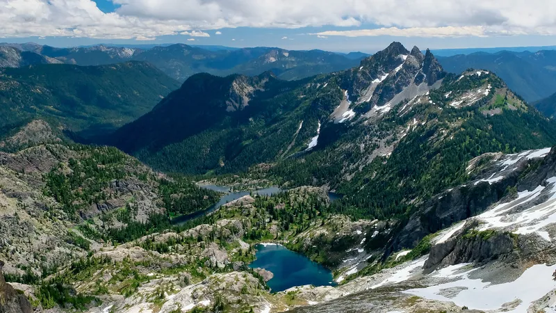
The Pacific Northwest’s stunning Cascade Range is home to some of America’s most iconic volcanoes. Many visitors hiking through these majestic mountains wonder when these sleeping giants last roared to life. The most recent volcanic activities in the Cascade Range occurred at Lassen Peak in California between 1914-1917 and the major eruption of Mount St. Helens in Washington in 1980. These eruptions remind us that the Cascade Volcanic Arc remains active today.
The Cascade Range has a rich history of volcanic activity spanning over 500,000 years. During the past 4,000 years alone, eruptions have occurred at an average rate of about 2 per century, making this one of North America’s most volcanically active regions. With nearly 20 major volcanoes and over 4,000 separate volcanic vents, the landscape has been dramatically shaped by these powerful forces of nature.
Find available hotels and vacation homes instantly. No fees, best rates guaranteed!
Check Availability Now
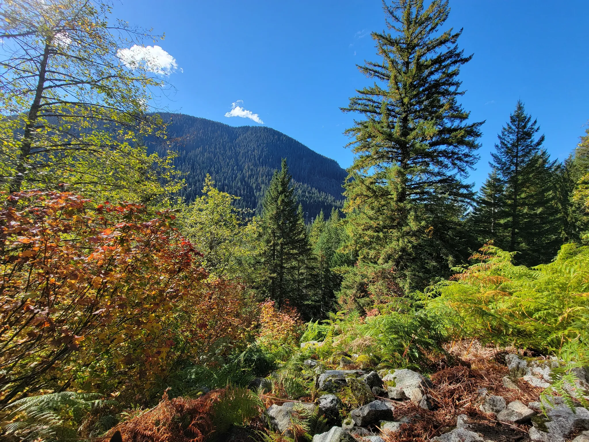
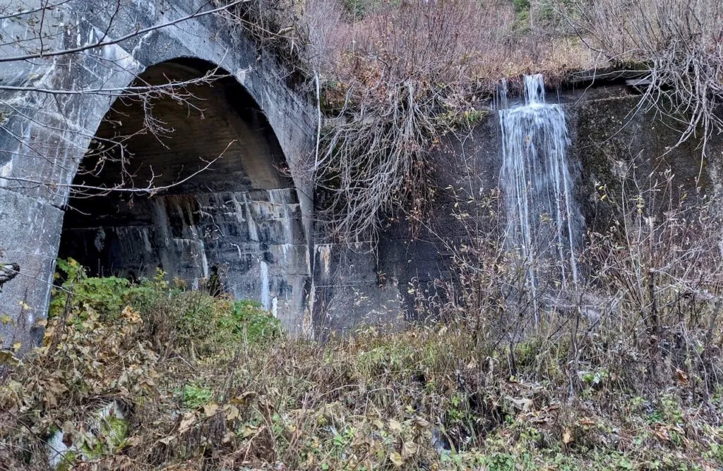
Travelers exploring these magnificent mountains can witness the aftermath of past eruptions while enjoying breathtaking scenery. The catastrophic 1980 eruption of Mount St. Helens transformed the surrounding environment in ways still visible today. For those interested in experiencing this volcanic history firsthand, the Iron Goat Trail in Washington offers hikers a fascinating journey through terrain shaped by these ancient forces, with stunning views of the Cascades that tell the story of our dynamic planet.
Recent Eruptions and Volcanic Activity
The Cascade Range has experienced significant volcanic activity in recent decades, with Mount St. Helens providing the most dramatic examples of eruptions in the region. Monitoring systems throughout Washington and Oregon help scientists track potential volcanic threats.
The 2004–2008 Eruption of Mount St. Helens
Mount St. Helens, the most active volcano in the Cascade Range, famously erupted in 1980, but its more recent 2004-2008 eruption provides important insights into volcanic behavior. This eruption was less explosive than its predecessor but still remarkable.
The activity began in September 2004 with a series of small earthquakes indicating magma movement beneath the volcano. By October, the volcano was steadily releasing ash and steam into the atmosphere.
Unlike the lateral blast of 1980, this eruption primarily built a new lava dome inside the crater. The dome grew at an astonishing rate—sometimes adding up to 7 feet of new material daily.
Scientists observed the slow, steady extrusion of thick, pasty lava that formed spine-like features nicknamed “the whale” and “the whaleback” due to their distinctive shapes.
Monitoring Techniques and Predictions
Modern volcano monitoring in the Cascade Range employs sophisticated technology to detect warning signs before eruptions occur. The Pacific Northwest Seismic Network maintains instruments on all potentially active volcanoes in Washington.
Key monitoring methods include:
- Seismometers to detect earthquake swarms
- GPS stations to measure ground deformation
- Gas sensors to analyze volcanic emissions
- Thermal cameras to track temperature changes
Mount Rainier, Mount Baker, and Glacier Peak are all closely watched due to their potential hazards. Scientists can now identify patterns that might precede an eruption, giving communities valuable warning time.
Hikers on the popular Iron Goat Trail in Washington can see firsthand how volcanic landscapes have shaped the region, with educational signs explaining the connection between the trail’s terrain and the Cascade’s volcanic history.
Impact of Volcanic Activity in the Cascade Range
Volcanic eruptions in the Cascade Range have shaped both the natural landscape and human communities throughout the Pacific Northwest. These powerful events create immediate changes and long-lasting effects that continue to influence the region today.
Environmental and Geological Effects
The Cascade Range’s active volcanoes dramatically transform their surroundings when they erupt. Volcanic ash can blanket vast areas, initially damaging plants but eventually enriching soils with minerals. Mount St. Helens’ 1980 eruption illustrated this cycle perfectly – destroying forests instantly but creating fertile ground for new growth.
Lahars (volcanic mudflows) reshape river valleys by depositing sediment and altering water courses. These dangerous flows can travel for miles beyond the volcano, changing landscapes far from the eruption site.
New landforms emerge after eruptions, including lava domes, crater lakes, and ash plains. These features create diverse habitats for plants and animals, supporting unique ecosystems that wouldn’t exist otherwise.
The Cascadia Subduction Zone powers this volcanic chain, as the Juan de Fuca plate slides beneath North America. This ongoing geological process ensures the range will remain active for millennia to come.
Societal and Economic Consequences
Communities near the Cascade volcanoes face both benefits and risks from their volcanic neighbors. Tourism brings significant revenue to areas like Mount Rainier and Mount Hood, where visitors flock to experience these majestic peaks. Yet the threat of eruption requires constant vigilance.
Volcanic ash poses serious hazards to:
- Air travel (causing flight cancellations)
- Water supplies (contamination)
- Infrastructure (building damage)
- Agriculture (crop destruction)
Towns throughout Washington, Oregon, and northern California maintain eruption preparedness plans. Early warning systems help reduce risk, though a major event would still cause significant disruption and potential loss of life.
The historical pattern of Cascade eruptions shows they remain an ongoing threat. Hikers on trails like the Iron Goat in Washington can see evidence of past volcanic activity in the landscape, a reminder of the powerful forces that continue to shape this beautiful but volatile region.
Find available hotels and vacation homes instantly. No fees, best rates guaranteed!
Check Availability Now
Iron Goat Trail Hiking Guide: Exploring Washington’s Scenic Railway Path
Iron Goat Trail History: Exploring the Legacy of the Great Northern Railway
Things to Do Near Skykomish, Washington
