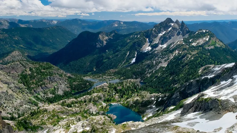
The Pacific Northwest landscape is dramatically shaped by the presence of impressive volcanoes rising from the Cascade Range. This mountain chain stretches from northern California through Oregon and Washington, and extends into British Columbia. The Cascade Range in the United States contains around 20 major volcanoes among over 4,000 separate volcanic vents including stratovolcanoes, shield volcanoes, lava domes, and cinder cones. While many of these impressive peaks sleep quietly, they are part of a dynamic volcanic system with a fascinating geological history.
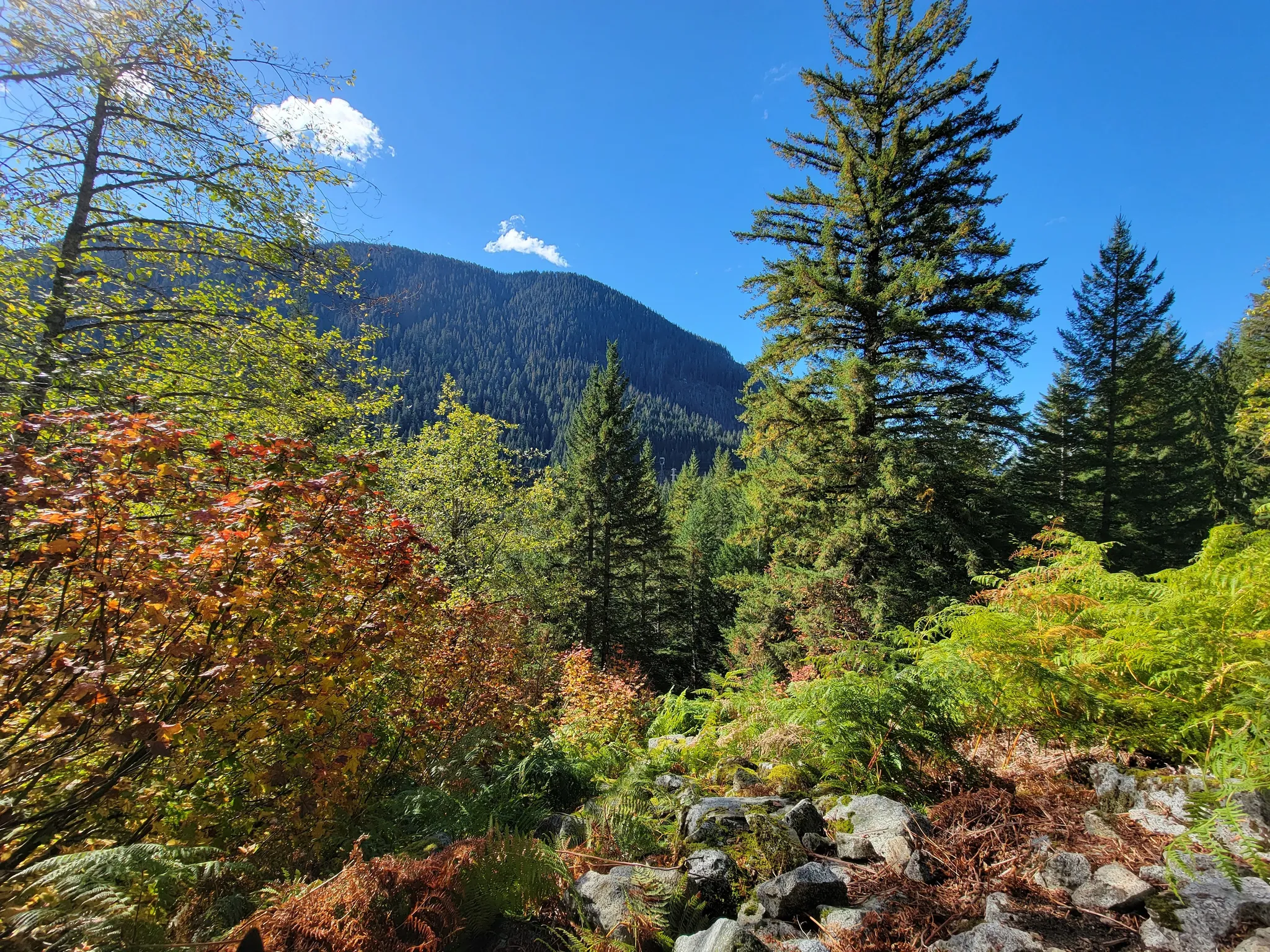
Many travelers are drawn to these majestic mountains without realizing they’re admiring the Cascade Volcanoes, formed through millions of years of subduction along the Cascadia subduction zone. The United States Geological Survey monitors these giants closely, as the Pacific Northwest is home to some of America’s most dangerous volcanoes. Hiking enthusiasts exploring trails like the historic Iron Goat Trail in Washington can witness firsthand how volcanic forces have sculpted this incredible terrain, creating both challenges and breathtaking beauty for generations of adventurers.
Find available hotels and vacation homes instantly. No fees, best rates guaranteed!
Check Availability Now
Profile of Key Cascade Volcanoes
The Cascade Range contains several prominent volcanoes with unique characteristics and eruption histories. These mountains shape the landscape and culture of the Pacific Northwest.
Mount St. Helens
Mount St. Helens is perhaps the most famous of the Cascade volcanoes due to its catastrophic eruption on May 18, 1980. This eruption blasted away the northern flank of the mountain, reducing its height from 9,677 feet to 8,363 feet.
The 1980 eruption killed 57 people and caused widespread destruction, becoming the deadliest and most economically damaging volcanic event in U.S. history. It spread ash across several states and dramatically changed the surrounding landscape.
Today, visitors can observe the remarkable ecological recovery at the Mount St. Helens National Volcanic Monument. The mountain remains active with periodic dome-building eruptions, most recently between 2004 and 2008.
Hiking trails around the volcano offer stunning views of the blast zone and crater, showing nature’s resilience in the face of devastation.
Mount Rainier
Standing at 14,411 feet, Mount Rainier is the tallest volcano in the Cascade Range and the most glaciated peak in the contiguous United States. Its massive size dominates the skyline around Seattle and Tacoma.
Mount Rainier is considered one of the most dangerous volcanoes in America due to its potential for lahars – volcanic mudflows that could threaten densely populated areas. The mountain contains about 26 major glaciers covering approximately 35 square miles.
The volcano last erupted in the 1800s but shows signs of ongoing activity. Scientists monitor it closely because of the risks it poses to nearby communities.
Mount Rainier National Park attracts millions of visitors yearly for hiking, climbing, and wildlife viewing. The Wonderland Trail, a 93-mile path, circles the entire mountain and showcases its diverse ecosystems.
Mount Hood
Mount Hood rises to 11,249 feet as Oregon’s highest peak and is located just 75 miles east of Portland. This stratovolcano features a distinctive cragged peak shaped by glaciers and past eruptions.
The mountain has experienced several eruptions in the last few thousand years, with the most recent significant activity occurring in the 1790s. Smaller eruptive events were reported in the mid-1800s.
Mount Hood hosts year-round recreation opportunities:
- Winter: Skiing and snowboarding at several resorts
- Summer: Hiking and climbing on dozens of trails
- Fall: Beautiful foliage viewing around the mountain
The iconic Timberline Lodge on Mount Hood’s southern slope served as the exterior of the hotel in Stanley Kubrick’s film “The Shining” and remains a popular tourist destination.
Mount Adams
Mount Adams, the second-highest volcano in Washington at 12,280 feet, is often overlooked despite its massive size. This stratovolcano features a broad summit and sits about 30 miles east of Mount St. Helens.
Unlike its more famous neighbors, Mount Adams has been relatively quiet in recent geological history. Its last significant eruption occurred approximately 1,000 years ago, though minor steam explosions have happened more recently.
The mountain is partly located within the Yakama Nation Reservation and holds cultural significance for several Native American tribes. Its name in the Klickitat language is “Pahto” or “Klickitat.”
Mount Adams features more than a dozen glaciers and offers excellent backcountry skiing and hiking opportunities. The South Climb route is popular among mountaineers seeking a challenging but non-technical ascent.
Glacier Peak
Glacier Peak is one of the most remote major volcanoes in the Cascade Range, rising to 10,541 feet in the heart of the Glacier Peak Wilderness. Despite its distance from population centers, it ranks among the most explosive of the Cascade volcanoes.
This volcano has erupted explosively at least six times in the past 4,000 years. Geologists consider it one of Washington’s most active and potentially hazardous volcanoes due to its history of explosive eruptions.
Access to Glacier Peak requires lengthy hiking through pristine wilderness areas. The Pacific Crest Trail passes near its eastern slopes, offering hikers spectacular views.
The mountain supports numerous glaciers that feed the Suiattle, White Chuck, and Sauk Rivers. These glaciers have been retreating in recent decades due to climate change.
Mount Shasta
Mount Shasta towers over Northern California at 14,179 feet, making it the second-highest peak in the Cascades. This massive stratovolcano consists of four overlapping volcanic cones, including the main summit and Shastina.
The mountain has erupted roughly once per 800 years during the last 10,000 years, with the most recent significant eruption occurring about 200 years ago. Future eruptions could produce lava flows, pyroclastic flows, or lahars.
Mount Shasta holds spiritual significance for many Native American tribes and New Age practitioners who consider it a sacred site. Legends claim it harbors a hidden city inside the mountain.
Adventurous travelers can climb to the summit via several routes of varying difficulty. The mountain’s diverse ecosystems include ancient forests, alpine meadows, and barren volcanic terrain.
Visitors exploring the Cascade volcanoes might also enjoy the historic Iron Goat Trail in Washington, which offers a fascinating glimpse of railroad history alongside spectacular views of the Cascade Range.
Volcanic Activity and Hazards
The Cascade Range volcanoes present significant hazards due to their explosive eruption style and proximity to populated areas. The U.S. Geological Survey monitors these volcanoes closely to protect nearby communities.
Volcanic Eruptions in History
The Cascade Range has a rich history of eruptions that shaped the landscape we see today. Mount St. Helens provided the most dramatic recent example when it erupted in 1980, killing 57 people and causing widespread devastation. The volcanic ash traveled thousands of miles, affecting communities far from the volcano.
Mount Rainier has experienced multiple eruptive activity periods over the past 2,500 years. Its last major eruption occurred around 1450, though smaller events have happened since.
Mount Hood’s last major eruption was in the 1790s, which created the sandy rivers and debris flows still visible today. Lassen Peak erupted between 1914-1917, marking the southernmost Cascade volcano to erupt in recent times.
Cinder cones like those near Mount Bachelor in Oregon represent smaller eruptions that occurred in the range’s volcanic fields. These historical eruptions remind visitors that the Cascade volcanoes remain active systems.
Understanding Volcanic Hazards
The Cascade volcanoes present several types of hazards to nearby communities. Lahars (volcanic mudflows) pose perhaps the greatest threat, especially from snow and glaciers that can rapidly melt during an eruption. These fast-moving slurries can travel many miles down river valleys.
Pyroclastic flows – superheated avalanches of gas, ash and rock – can move at hurricane speeds and destroy everything in their path. They’re particularly dangerous because they can occur with little warning.
Volcanic ash presents hazards to:
- Air travel
- Breathing (respiratory issues)
- Infrastructure (collapsing roofs)
- Water supplies
- Agriculture
The USGS ranks several Cascade volcanoes with “very high” volcanic threat scores, including Mount St. Helens, Mount Rainier, and Mount Hood. Each volcano has a unique hazard profile based on its history, magma composition, and proximity to population centers.
Monitoring and Predicting Eruptions
The U.S. Geological Survey maintains extensive monitoring networks across the Cascade Range volcanoes. These systems track earthquakes, ground deformation, gas emissions, and other indicators that might signal rising magma.
Scientists use sophisticated equipment including:
- Seismometers
- GPS stations
- Gas-monitoring tools
- Satellite imagery
- Thermal cameras
This data helps detect changes in volcanic activity that might precede an eruption. For example, small earthquake swarms often indicate magma movement beneath a volcano.
The USGS Volcano Hazards Program provides regular updates on volcanic conditions. They use a color-coded alert system similar to traffic lights to communicate threat levels to the public and aviation authorities.
Hikers on trails near Cascade volcanoes, like the popular Iron Goat Trail in Washington, should always check current activity reports before visiting. The Iron Goat Trail offers stunning views of the Cascades while winding through an area shaped by these powerful geological forces.
Find available hotels and vacation homes instantly. No fees, best rates guaranteed!
Check Availability Now
Iron Goat Trail Hiking Guide: Exploring Washington’s Scenic Railway Path
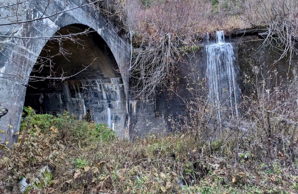
Iron Goat Trail History: Exploring the Legacy of the Great Northern Railway
Things to Do Near Skykomish, Washington
